Mohenjo-daro is often discussed because of its impressive ruins, but its overall city plan may be even more revealing.
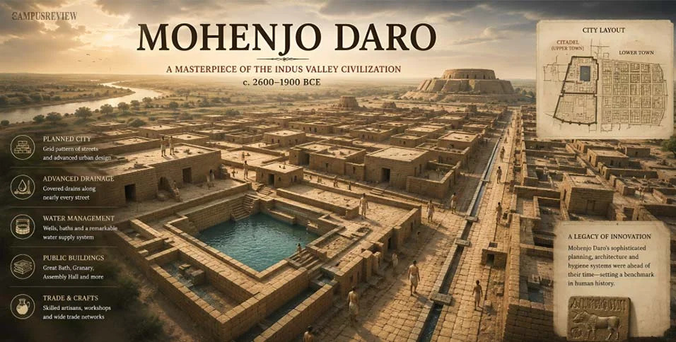
UNESCO identifies the settlement's citadel, lower town and organized streets as evidence of an early system of urban planning.
The city also had extensive drainage infrastructure. Archaeological research shows that street drains were constructed using baked bricks and that some household bathing areas were connected to these systems.
This raises an interesting historical question:
What level of organization was required to design and maintain such infrastructure?
A city needs more than individual builders to create coordinated streets, drainage and public structures. It suggests that the inhabitants had systems for construction, maintenance and managing shared urban spaces.
The map helps us visualize this organization.
Instead of studying isolated ruins, we can look at relationships between neighborhoods, streets, public buildings and water infrastructure.
This makes Mohenjo-daro particularly interesting for discussions about the origins of urban planning.
What do you think the city's layout tells us about the society that built it?
Explore the complete map guide:
Mohenjo-Daro Map and City Planning
https://thecampusreview.com/history-and-culture/mohenjo-daro-map/#MohenjoDaro #UrbanHistory #Archaeology #IndusCivilization #HistoryDiscussion


 Locked